Mapping the Web – The Internet as Universe and The Deleted City
The Deleted City
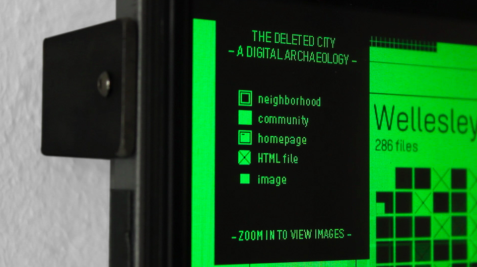
By zooming in and zooming out, you can navigate through the digital Pompeii of millions of abandoned homepages. While you pass the neighbourhood called ‘Pentagon’, you see military images and short stories about the army. Entering another district ‘Vienna’, you are confronted with information about classical music and ballet.
Long before the rise of social media like Facebook and Twitter, GeoCities was used by tens of millions of users to conquer their own territory online. They created their own homepages for free, containing information about themselves or topics that they were specialised in. By connecting these homepages by theme, neighbourhoods like Vienna or Pentagon emerged.
Richard Vijgen created The Deleted City (2011), a visualization of 650 gigabyte of deleted homepages. With his interactive datavisualization you can navigate endlessly through the digital Pompeii.
In 2009 GeoCities was taken offline by Yahoo!, that bought the digital city in 2001 for 3,5 billion dollar. Just before the website was finally deleted, The Archive Team made a back up of 650 gigabyte of data, that was generated by 35 million users over ten years.
Richard Vijgen reordered the archive by neighbourhood, and visualized it as a large blueprint of a city with houses. In the visualization, you find the names of the neighbourhood and by zooming in you can visit the individual homepages of the users. By visualizing the remains of GeoCities, this part of web history is not just archived, but actually accessible and navigable by end users.
Mapping the Web

The Deleted City
Mute Books Orders
For Mute Books distribution contact Anagram Books
contact@anagrambooks.com
For online purchases visit anagrambooks.com


